Union of New Brunswick Indians
Stay informed by Subscribing to UNBI's Newsletter.

| DRAINAGE BASIN / COMPOSITE | DRAINAGE AREA (km2) |
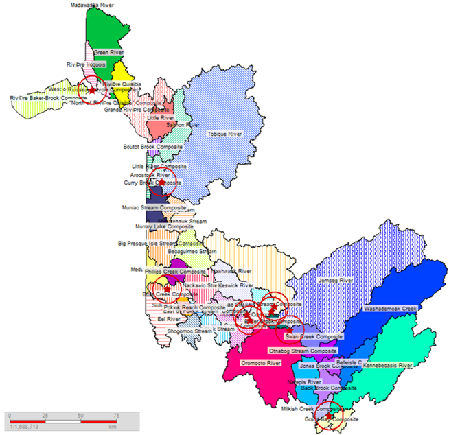
| 01. Saint John River Basin | 28,860.15 |
| 02. Miramichi River Basin | 13,546.65 |
| 03. Restigouche River Basin | 6,603.91 |
| 04. St. Croix River Basin | 1,653.34 |
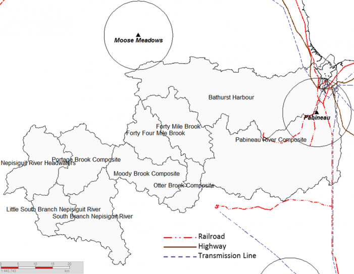
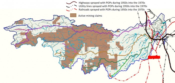
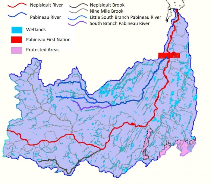
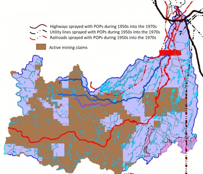
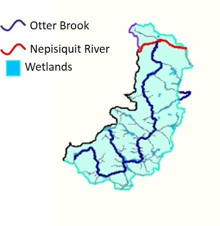
| 05. Nepisiguit River Basin | 3,091.97 |
| 06. Petitcodiac River Basin | 2,831.93 |
| 07. Northumberland Strait Composite | 4,707.44 |
| 08. West Fundy Composite | 3,727.74 |
| 09. Acadian Peninsula Composite | 3,188.45 |
| 10. Chaleur Bay Composite | 2,195.59 |
| 11. East Fundy Composite | 1,515.16 |
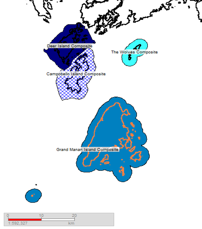
| 12. Fundy Isles Composite | 237.32 |
| 13. Inner Bay of Fundy Composite | 494.39 |
PROVINCIAL TOTAL | 72,656.04 |
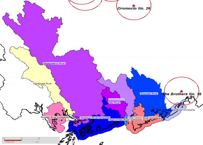
"At-risk" Watersheds (at least <40% Crown forest cover <35 years old)
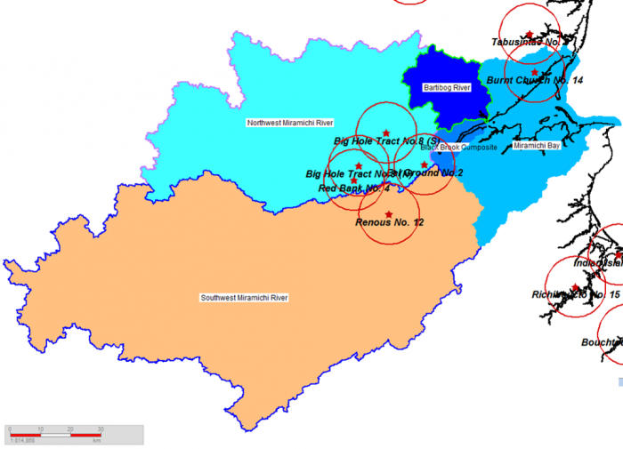
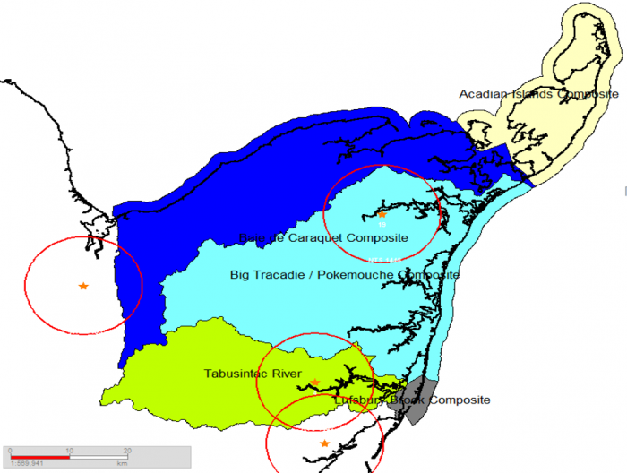
"At-risk" Watersheds (at least <40% Crown forest cover <35 years old)
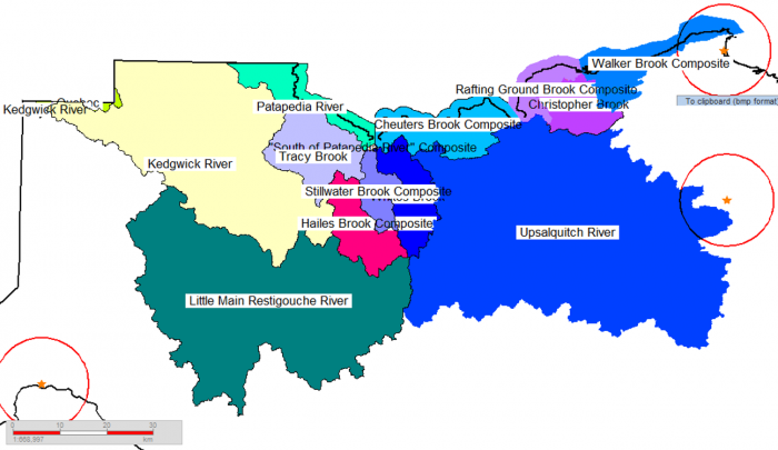
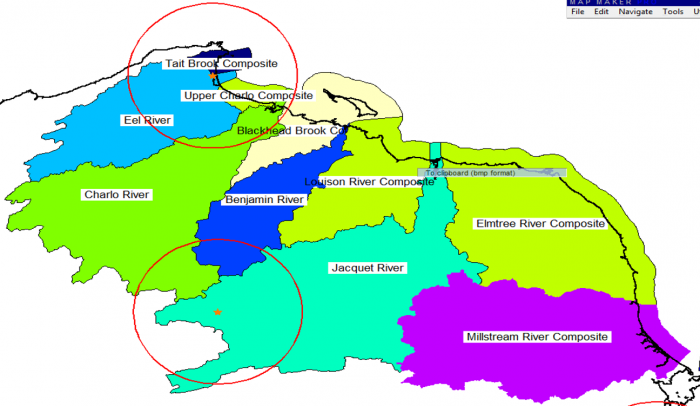
"At-risk" Watersheds (at least 40% Crown forest cover <35 years old.
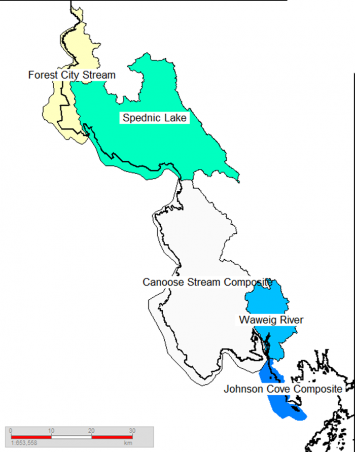
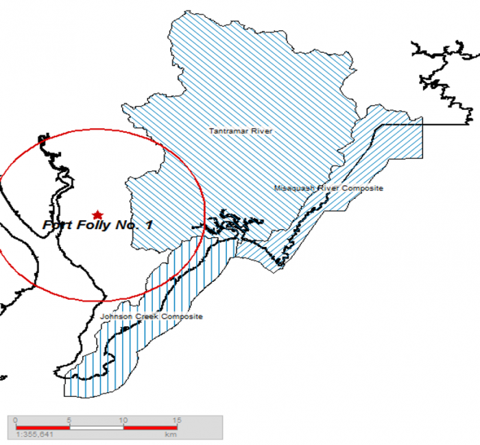
"At-risk" Watersheds (at least 40% Crown forest cover <35 years old)
"At-risk" Watersheds (at least 40% Crown forest cover <35 years old) NB’s watersheds at risk. Megan de Graaf, NB Media Co-op, April 16, 2008..
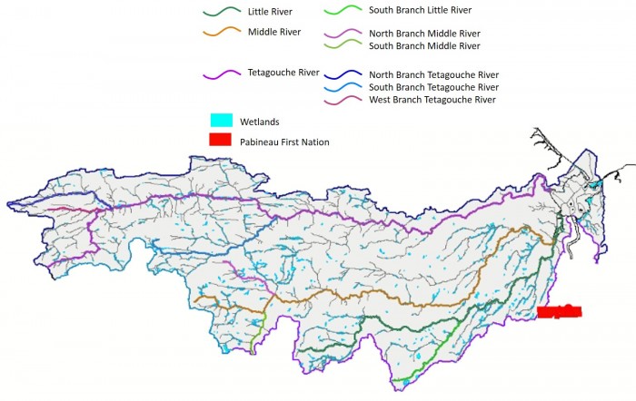
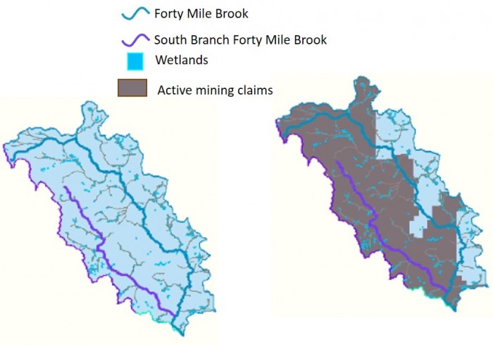
1. Middle River Headwaters
2. Little River
Location Along Railroad | Lead (ppm) | Zinc (ppm) | Arsenic (ppm) | Copper (ppm) |
| Between Pabineau + Brunswick Mines Crossing Rte 430 | 1,890 | 5,670 | 46 | |
| Parallel to Rte 430 | 1,180 | 1,850 | 26 | 197 |
| Past Pabineau crossing Rte 430 | 444 | 1,120 |
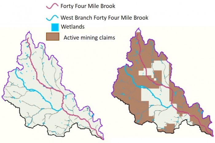
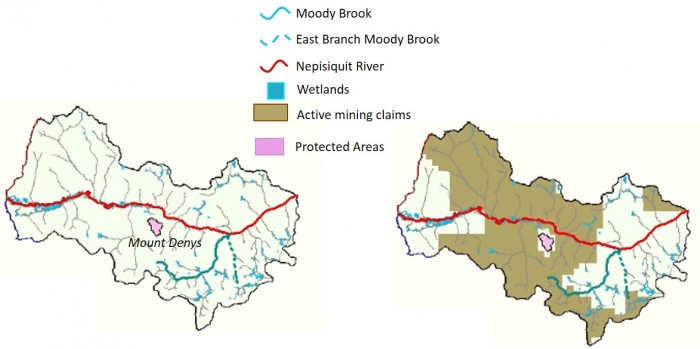
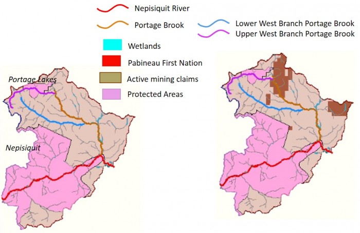
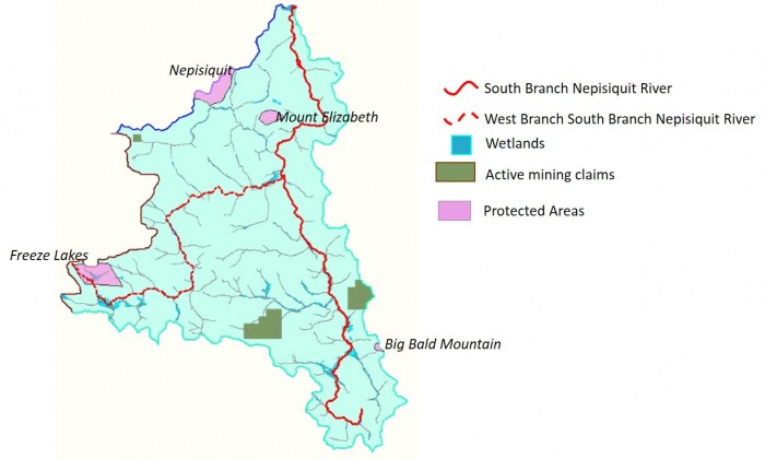
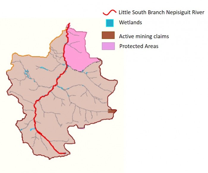
The South Branch Nepisiguit River, with 62% of the land base covered in Crown forest less than 35 years old, is the most critically affected watershed in the province.